|


| |
 |
 |
|
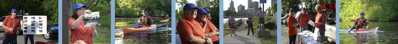
Self guided tours on
the Blackstone Note :
Water conditions vary seasonally, what may be a calm section one
season may have a strong current and difficult rapids in another. A
major storm can even change the conditions significantly in a matter
of hours. Therefore, caution is necessary at all times.. it is
recommended that paddlers check the water level and river conditions
prior to every trip. Historically, the water in the Blackstone River
has suffered the effects of the industries that grew up along its
banks. In more recent years, the river has been cleaned up
significantly. However, paddlers are advised not to intentionally
come in contact with the water. |
Information gathered from the "Canoe Guide"
for the Blackstone River, which was produced as a cooperative effort
between the National Park Service, the Blackstone River Valley National
Heritage Corridor and the Blackstone River Watershed Association.
The story of the Blackstone River and Canal can be told from many
vantage points. Perhaps the best way to experience its history and
beauty is with a canoe or kayak beneath you and a paddle in your hand.
The Blackstone is referred to " America's Hardest Working River". It
flows through urban developments, historic villages, farmland and
forests for 46 miles from Worcester MA to Pawtucket RI. It drops an
average of ten feet per mile, steeper than even the Colorado River
through the Grand Canyon.
The river has been recognized as an early resource for Native Americans
and an exploitable resource since the area's settlement by the Europeans
in the 1640's.Various mills began to appear in the 1670's and the first
successful cotton mill in the New World, Slater Mill was erected at the
mouth of the river in 1793. The almost wholly-preserved 19th century
landscapes, buildings and villages along the river give it national
importance, recognized in 1986 when Congress created the Blackstone
River Valley National Heritage Corridor.
The Blackstone Canal was opened in 1828 and ferried passengers and
freight between Worcester and Providence for twenty years. The canal was
replaced by the Providence and Worcester Railroad in 1848. While most of
the canal locks were dismantled, evidence of the canal still exists in
many locations.
Many sections of the river and canal, are navigable by canoe or kayak.
However, some sections require greater skill than others, and difficult
portages are sometimes necessary. The Blackstone River Canoe Guide
provides the necessary information to canoe the river while learning
about it varied natural and cultural history.
|
| *River Classifications Flatwater- There is little or no current,
and the river's surface is smooth and unbroken. paddling upstream is
easy.
Quickwater- The river moves fast. Its
surface is nearly smooth at high water levels, but likely to be
choppy at medium levels and shallow at low water levels.
Class I- Fast moving water with a riffles and small waves.
Few or no obstructions, all obvious and easily missed with little
training. Risk to swimmers is slight; self-rescue is easy.
Class II- Straight forward rapids with wide, clear channels
which are evident without scouting. Occasional maneuvering may be
required, but rocks and medium-sized waves are easily missed by
trained paddlers. Rapids with waves up to three feet
Class III- Rapids with high, irregular
waves which may be difficult to avoid often capable of swamping an open canoe. Narrow passages that
often require complex maneuvering in fast current. Good boat control
required: large waves or strainers may be present. Strong eddies and
powerful current effects can be found, particularly on large-volume
rivers. May require scouting from shore. Group assistance may
be required to avoid long swims.
Class IV- Intense, powerful but predictable rapids requiring
precise boat handling in turbulent water. Depending on the
character of the river, it may feature large, unavoidable waves and
holes or constricted passages demanding fast maneuvers under
pressure. A fast, reliable eddy turn may be needed to initiate
maneuvers, scout rapids or rest. Rapids may require "must"
moves above dangerous hazards. Scouting is necessary the
first time down. Risk of injury to swimmers is moderate to
high, and water conditions may make self rescue difficult.
Class V- Extreme. These runs often exemplify the
extremes of difficulty, unpredictability, and danger. The
consequences of errors are very severe and rescue may be impossible.
For teams of experts only, at favorable water levels, after close
personal inspection and taking all precautions.
(*AMC River Guide descriptions)
|
|
|
Navigable Tributaries
Quinsigamond River
Approximately 4 miles of the Quinsigamond River are navigable from
Rt. 122 in Grafton to its confluence with the Blackstone River at
Fisherville Pond. From Route 122 paddlers can paddle upriver under the
Massachusetts Turnpike and explore large marshy areas. The river offers
pleasant scenery with one portage at Lake Ripple before entering the
Blackstone.
|
| Mumford River
For about 11 miles th Mumford River winds its way toward the
Blackstone River from the village Manchaug in Sutton. Beginning at
Manchaug Street, paddlers will enjoy the remote nature of the river and
its lazy currant to Douglas. In Douglas are several stretches of
quickwater before settling into the slackwater of Lackey Pond. From
Lackey Pond the river cascades into Meadow Pond at Lackey Dam. After a
long portage in Whitinsville, there is another small section of
quickwater before settling into the slackwater of Linwood Pond. After
portaging around the dam at Linwood Pond and two more dams in Uxbridge,
the Mumford joins the Blackstone River.
|
| West River
From Pleasant Street in Upton, the West River travels about 7.5 miles
through undeveloped land to the Blackstone. After putting in, paddlers
will encounter a meandering, sometimes narrow river to the West Hill Dam
in Uxbridge. Portage around the dam and continue to the dam at Rt. 16 in
Uxbridge. From here the river has several quickwater sections and sharp
turn that make for an interesting ride. The native and stocked trout
that are in the river, in addition to several areas hospitable to
waterfowl make the West River a favorite of local sportsmen.
|
| Mill River
The Mill river can be paddled for about 12 miles from Rt. 140 in
Hopedale through Mendon and Blackstone to its confluence with the
Blackstone River in Woonsocket. The final several hundred yards,
however are contained in a large flood control culvert and, thus, cannot
be paddled.
|
| The Branch River
13 miles of various river conditions, including Class I and Class II
stretches, await paddles on the Branch River. Beginning at the
confluence of the Pascoag and Chepachet Rivers in Burriville, paddlers
will enjoy its remote scenery and variety of conditions. Whitewater
conditions are primarily a factor of rainfall or scheduled dam releases,
contact the RI Canoe and Kayak Association.
|
|
|
|
|