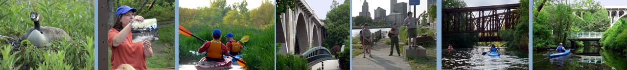
|
|
|
Requirements
for Blackstone Paddlers Events.
Questions ?
Contact Cheryl
StoneFoxFarm@juno.com 401-647-5887.
Complete BVPC Calendar
Check out the
BVPC
paddling
Pictures
We look forward to paddling with you from May
through August 2010.
|
|
6:15pm Lacky Dam and
the Mumford River. Come join us as we kick off our 8th season on
the beautiful Mumford River. The water levels should be high enough in
May to allow us to paddle further up the river than we have in years past.
This is always a popular paddle.
Suitable for all levels of experience
Directions: Take 146 north into Whitensville, take the
exit that reads Lackey Dam Road/Whitensville. At end of exit take a right,
follow road approximately 1/2 mile to the dam. Parking is available on
the service road to the dam. Paddle through Lackey Pond into the Mumford
river.
N42 06.184 W071 41.394
|
|
6:15 pm -Quinsigamond
River Grafton Rentals Available
Riverview Apartments put-in
Suitable for all levels of
experience and a couple of paddling options for this trip.
Directions: Take Route 146 south into Sutton
MA. After the traffic light on 146 and Boston road, prepare to exit on the
next exit which is Central Turnpike. Take the Central Turnpike exit. Head
east toward Northbridge. The road become Sutton road, continue straight
east. At the stop sign at the five way intersection at Adam's Corner,
continue straight. Drive down the big hill into Rockdale. The road comes to
a T intersection. Make a left onto route 122. Head North into Grafton.
Shortly after in Grafton 122 and 122A split. A Cumberland Farms store sits
precariously in the middle. Stay on Route 122 (to the right) for another
mile. Turn left at the sign for RiverView Apartments. Follow
road 1/4 mile to end (it becomes a dirt road).
Driving Directions from Providence
Take Route 146 North. Drive past the three Northbridge exits, but after the
Purgatory Rd. exit, begin to watch for the sign for Central Turnpike. Take
the Central Turnpike exit. At the top of the ramp turn right and head east
on Central Turnpike toward Northbridge. The road become Sutton road,
continue straight east. At the stop sign at the five way intersection at
Adam's Corner, continue straight. Drive down the big hill into Rockdale. The
road comes to a T intersection. Make a left onto route 122. Head North into
Grafton. Shortly after in Grafton 122 and 122A split. A Cumberland Farms
store sits precariously in the middle. Stay on Route 122 (to the right) for
another mile. Turn left at the sign for RiverView Apartments.
Follow road 1/4 mile to end (it becomes a dirt road). Note: You can also
follow 122 to get to the put in.
Alternate
directions:
Directions: 146N take a right onto Boston Rd ( Tony's
Pizza on left) Follow 1.2 miles to the end. Take a right onto
Providence Road or 122A South. At 1.8 miles, turn left onto Cross Street
(it’ll be before the Valley Plaza Discount Liquor Plaza & sign). Take Cross
Street (aptly named because it conntects 122A to Route 122) to the end and
turn left onto Route 122 North for 0.7 miles – turn left into Riverview
Apartments and continue following the road (it’ll turn into a dirt road that
takes you to the put in).
Note: if you miss the left turn onto Cross
Street, and you get to the Cumberland Farms store & gas station (0.3 miles
from Cross Street), you need to make a hard ‘V’ left turn onto 122N and
proceed 1.0 miles to Riverview Apts on the left.
From the Worcester area:
Those coming from the Worcester area take 146S and
take a left onto Boston Rd (Tony's pizza on right) and follow
directions as above.
N 42 11 232
W071 41 652
Rentals: We have rental boats
available for people on the first and third Tuesday
evenings of the
month from our vendor
Great Canadian. (Membership requirements are
waived for those paddlers renting boats on our rental nights) We have a
limited number of kayaks and canoes that may be reserved for a fee.
To reserve a boat, call Great Canadian at 1-508-865-0010. Call to
leave a message with your request (kayak or canoe), and Great Canadian will
return your call with a confirmation. .Great Canadian will drop off
your boat at the paddle location and bring it back to their shop after the
paddle.
|
|
6:15pm West
River Uxbridge MA
Suitable for all levels of experience
Naturalist Julie Reindeau will be leading this trip.
You'll have the chance to see lots of wildlife as you paddle upstream
through this stretch of clean, clear flatwater. The West River, like the
Nipmuc River has excellent water quality and is one of our rivers that is
clean enough to swim in the Blackstone Valley.
Directions: From 146 (North or South), take the
Route 16 Exit. Take Rt. 16 East for 2 miles. You'll then pass through the
Rt. 16/Rt. 122 intersection in downtown Uxbridge. Continue on Rt. 16 for 1
more mile. Look for a red building, Countryside Garden Center, on the left.
Take a left onto West River Road, the street immediately following the
Garden Center. Go approximately 200 feet and park in the gravel lot on the
right side of road.
N42 05.049 W071 36.505
|
|
Rental Night 6:15pm
Blackstone River- Albion to Manville RI
Rentals Available
Suitable for all levels of
experience. Put-in
above the Albion Dam and paddle upstream to the Manville Dam and back.
A great paddle on the Blackstone River.
Directions: From 295N
Take Exit 10 – Route 122 – Cumberland
Take a right at end of ramp
Proceed approximately .4 miles
Take a left on to Albion Road – look for a CVS on the corner
Proceed approximately .7 miles. You will see a sign for the Blackstone
River
State Park on the right. Additional parking is available across the
street.
Put in is located up the bike path about 100 feet.
From 295N
Take Exit 10 – Route 122 – Cumberland
Take a right at end of ramp
Proceed approximately .1 miles
Take a left on to Albion Road – look for a CVS on the corner
Proceed approximately .7 miles. You will see a sign for the Blackstone
River
State Park on the right. Additional parking is available across the
street.
Put in is located up the Bike Path about 100 feet.
Rentals:
We have rental boats
available for people on the first and third Tuesday
evenings of the
month from our vendor
Great Canadian. (Membership requirements are
waived for those paddlers renting boats on our rental nights) We have a
limited number of kayaks and canoes that may be reserved for a fee.
To reserve a boat, call Great Canadian at 1-508-865-0010. Call to
leave a message with your request (kayak or canoe), and Great Canadian will
return your call with a confirmation. .Great Canadian will drop off
your boat at the paddle location and bring it back to their shop after the
paddle.
|
|
6:15pm
Nipmuc River and Harrisville Pond, Harrisville RI
Naturalist Julie Reindeau will be leading this trip.
Suitable for all levels of
experience
This river, above the pond and above where the Clear
River enters, is listed by the state as pristine water, the state's highest
rating for water quality. Note, if you choose the river route,
there are numerous beaver dams to drag your boat over. The river is
very narrow with lots of turns.
Directions from the South: Quickie directions: 146 North to Route 102
West to East Ave to Harrisville to Route 98 and the Harrisville Fishing Area
just outside of town by the green bridge.
*More detail: Take Route 146 North (On 146
North, make sure you stay left when 146 and 146A split) to the Forestdale/Slatersville
exit. At the top of the ramp, make a sharp left on to School Street. School
Street merges into and becomes Greene Street in Slatersville. Greene Street
then gets renamed Route 5/Main Street! Follow Main street a ways. You will
notice Slater Reservoir off to your left. Eventually you will get to Gator's
Pub and an intersection with Route 102/Bronco Highway. Make a left onto
Bronco Highway. Once you enter Burriville on Route 102, you will watch for
East Avenue and a sign for Harrisville at a traffic light (it should be the
second light at an intersection you come to.) Turn right and follow East
Avenue all the way into Harrisville. When you enter the town you will drive
over a bridge next to the dam. Turn right onto Route 98 at the next
intersection. Just outside of town on Route 98, is a large green truss
bridge. Park next to the bridge by the Harrisville Fishing Area Sign.
Directions from the North: Quickie directions: 146 South to Chocolog
Rd. Right on 146A by Darling Farm. Right on 98 south to green truss bridge
by Harrisville fishing area.
*More Detail: Take Route 146 South until you
get to the Chocolog Rd. Exit. At the end of the ramp turn left onto Chocolog
Rd. and head towards Route 146A and Uxbridge. By the Darling's Sewer
service, turn right onto the Quaker Highway/Route 146A. Turn Right onto
Route 98/Aldrich Street by the Little Texas Restaurant and the old Brick
Quaker Meeting House. Drive about seven miles south on Route 98. During that
seven miles, you will cross into Rhode Island. Watch for the large Sherman
Farm because just after the farm is a large green truss bridge. We will be
parking by the bridge. If you get to the Harrisville Fire Station, you have
gone too far.
GPS coordinates for the put-in: N 41 58.258'
W071 40.738' |
|
Rental Night
6:15pm Slatersville Reservoir- North Smithfield RI
Rentals Available
Suitable for all levels of experience
This trip provides a nice paddle through a flatwater
section of upper Slatersville Reservoir and then a stretch of the Branch
River.
GPS Coordinates: N41 59. 243
W071 36.073
Directions from North: From 146 South, take the
Slatersville exit.
Take a right off the ramp onto Great Road/Victory
Highway. Travel approximately 1.5 miles. Go straight through the light,
continuing on Victory Highway (Route 102), and travel another mile. You'll
see a DEM sign for the Slatersville Boat Launch on left-hand side. Park in
the dirt lot on the left (adjacent to the Slatersville Fishing Club Parking
Lot). If you get to the Burrillville town line you have gone too far.
Directions from South: From 146 North, take the
Slatersville Exit. Make a left off the ramp onto School Street. Travel 1.25
miles and merge (left) onto Greene Street. Travel straight on Greene St.
(which becomes Main St.) for another 1.25 miles. Take a left onto Victory
Highway (Route 102). Less than ¸ mile on left is a DEM Sign for Slatersville
Boat Launch. Park in the dirt parking area on the left- hand side. If you
get to the Burrillville town line you have gone too far.
Rentals: We have
rental boats
available for people on the first and third Tuesday
evenings of the
month from our vendor
Great Canadian. (Membership requirements are
waived for those paddlers renting boats on our rental nights) We have a
limited number of kayaks and canoes that may be reserved for a fee.
To reserve a boat, call Great Canadian at 1-508-865-0010. Call to
leave a message with your request (kayak or canoe), and Great Canadian will
return your call with a confirmation. .Great Canadian will drop off
your boat at the paddle location and bring it back to their shop after the
paddle.
|
|
June 24 - Ranger night River Bend Farm Loop 6:15pm
We will have a National Park Service Ranger paddling
with us this evening Paddle on the canal to
historic Goat Hill lock or experienced paddlers can paddle the loop,
down the river and then up the canal.
To paddle
the river section, strong padding skills are a must. There is a lot of
current and twisty turns with overhanging trees to avoid. An
alternate flatwater paddle to historic Goat Hill Lock is available for
paddlers wanting an easier route. Both trips will start and end at
River Bend Farm.
There will be leaders for both sections. There
will be a trip suitable for all levels of
experience.
Directions to River Bend Farm:
From Rt. 146 North or South: Take the exit for Rt. 16 East. Follow Rt. 16
East for about three miles into downtown Uxbridge. At light turn right and
immediate left, to continue on Rt. 16 East. After light, continue to second
left. Turn left onto Oak Street. Proceed north on Oak Street for about 1.5
miles, staying right at fork by school. River Bend Farm is on the right. The
parking lot is next to the red barn.
GPS coordinates: N 42 05 641 W071 37
442
|
|
6:15pm Lincoln Woods, Olney Pond in Lincoln RI
Training Night
Training nights are free of charge this year and included with your
membership or with a boat rental!
Suitable for all levels of experience.
Directions to Lincoln Woods state park.: Take
the Twin River Road exit from route 146 and follow the signs.
Turn right onto the ring road in the park ( you have to). Follow a few
miles to get to the state boat ramp.
Lincoln woods put in- boat ramp - N 41 53 370 W 071
25 684
Training night*
will be solely devoted to training those
paddlers interested in learning basic strokes that will allow them to better
control their boat, whether they paddle a canoe or kayak. Great
Canadian will rent boats for training nights as well. (Membership
requirements are waived for paddlers renting boats on our training nights.)
To reserve a boat, call Great Canadian at 1-508-865-0010. Call to
leave a message with your request (kayak or canoe), and Great Canadian will
return your call with a confirmation. Great Canadian will
drop off your boat at the paddle location and bring it back to their shop
after the paddle. There are no trips offered on these evenings.
|
|
6:15pm
Blackstone Gorge, Blackstone MA
Rentals Available
Naturalist Julie Reindeau will be leading this trip.
Suitable for all levels of
experience.
Paddle from the Gorge upriver to the Millville locks.
Come and see the improved canoe/kayak access. Lots of history and natural
beauty on this trip.
Directions from the North: Route 146 South: Take the Forrestdale/
Slatersville exit. At the top of the ramp turn left, then right at light
onto Rt. 146A. At next intersection with traffic light turn left onto St.
Paul Street. Follow St. Paul street until end at light at Route 122 (Main
Street) in Blackstone Mass. Take left at light. Follow Rt. 122 North for
about 1 mile. You will see brown and white sign directing you to turn left
onto County Street towards Blackstone Gorge. Gorge is at end of County
Street, parking lot on left.
Directions from the South: Take Route 146 North to the
Slatersville/Forestdale exit. Take a right at the top of the exit ramp, then
right at light onto Rt. 146A. At next intersection with traffic light turn
left onto St. Paul Street. Follow St. Paul street until end at light at
Route 122 (Main Street) in Blackstone Mass. Take left at light. Follow Rt.
122 North for about 1 mile. You will see brown and white sign directing you
to turn left onto County Street towards Blackstone Gorge. Gorge is at end of
County Street, parking lot on left.
GPS Coordinates: N42 00.923
W071 33.165
Rentals: We have rental
boats
available for people on the first and third Tuesday
evenings of the
month from our vendor
Great Canadian. (Membership requirements are
waived for those paddlers renting boats on our rental nights) We have a
limited number of kayaks and canoes that may be reserved for a fee.
To reserve a boat, call Great Canadian at 1-508-865-0010. Call to
leave a message with your request (kayak or canoe), and Great Canadian will
return your call with a confirmation. .Great Canadian will drop off
your boat at the paddle location and bring it back to their shop after the
paddle.
|
July 8th 6:15pm Wallum Lake
Douglas State Park, Douglas, Ma., Wallum Lake is located
on the border of RI and Ma., has crystal clear water, and an easy
paddle. Suitable for all levels of
experience.
Directions: 146 north exit for Rt 16 to Douglas/Uxbridge
Follow Rt 16 W thru the town of Douglas. You will
come to an intersection for Rt 16 & 96. GO STRAIGHT. (You will see a
sign for Douglas State Park/Wallum Lake) This is S. Main St. Follow
until you see a sign for Douglas State Park, take this left. Just down
the road take a right at park entrance. Follow road bearing left down the
hill to the put-in.
Also: Rt 395 exit 2 for town of Webster. Follow Rt 16 east until
you see a sign on the right for Douglas State Park or Cedar St.
Follow Cedar St to the end. Go straight across at sign for Douglas
State Park. Just down the road take a right at park entrance. Follow
road bearing left down the hill to put-in. |
|
6:15pm
Blackstone Canal- Kelly House- Cumberland, RI. River and
canal loop.
Ranger
Night We will have a National Park Service Ranger paddling with us
this evening. Rentals Available
There will be two options for paddling tonight. For experienced
paddlers with moving water skills you may paddle the river and the canal.
For people wanting an easier route, you have the option of padding the canal
section only. There will be leaders for both sections.
There will be a trip
suitable for all levels of experience.
Directions: 146 North or South to the Exit
for Rt. 116 North. ( Albion-Ashton Exit) Follow Rt. 116 to the
second light, Lincoln High School is on the left. Turn right at the
light and take a quick left onto River Road. Take the first left
after the Town Hall onto Cullen Hill Road. At the bottom of
road, turn left onto Lower River Road. Follow Lower River Road to
end. The parking lot is underneath the bridge for Rt. 116.
Rentals: We have rental
boats
available for people on the first and third Tuesday
evenings of the
month from our vendor
Great Canadian. (Membership requirements are
waived for those paddlers renting boats on our rental nights) We have a
limited number of kayaks and canoes that may be reserved for a fee.
To reserve a boat, call Great Canadian at 1-508-865-0010. Call to
leave a message with your request (kayak or canoe), and Great Canadian will
return your call with a confirmation. .Great Canadian will drop off
your boat at the paddle location and bring it back to their shop after the
paddle.
|
|
6:15pm
Providence River Stay tuned Date may
be changed
Bold Point, East Providence
Want a different view of the city, paddle with
us right up into the "Basin" at Waterplace Park and under the Providence
Place Mall. We will have a short
crossing to paddle before going through the hurricane barrier and into the
Providence River. There may be some chop while crossing. Kayak
skirts are recommended.
Directions: Take 195 East from Providence and
then take the Riverside Rt. 44 exit .. just over the Washington Bridge. Bear
right off the exit and make your VERY FIRST RIGHT TURN. (This comes
up quickly so watch for it). Take this road to the end and turn left. The
launch is a boat ramp on the right a short ways down- just after a large
dirt parking lot.
|
|
6:15pm Bowdish Lake Glocester RI
Training Night
Suitable for all levels of
experience.
Training nights are free of charge this year and
included with your membership or with a boat rental! Bowdish Lake has
very clean water and is great for a swim after the event.
From Worcester - Take Rt. 290 South until it becomes Rt. 395 South.
Continue to Exit 97 in Putnam Connecticut for Rt. 44 East. Follow Rt.
44 East for appox 7. 5 miles to G the George Washington Camping area
on your right. ( you will not be charged a day use fee). Go into the
campground and follow the one way signs for approx 1/4 mile.
From Rt. 146 South - Take Slatersville Exit. Turn right onto Rt.
146 A. At light by Slatersville Plaza, go straight on Rt. 102 South. Follow
Rt. 102 South for seven miles to intersection with Rt. 44 in
Chepachet. Turn right onto Rt. 44 West and continue about four miles
to the George Washington Camping area on your right (you
will not be charged a day use fee). Go into the campground and follow the
one way signs for approx 1/4 mile.
From Rt. 146 North - Take Slatersville Exit. Turn left off ramp
onto School Street. At intersection by Slatersville Common and Church,
veer left onto Green Street. Continue through Slatersville to first
light at Rt. 102. Turn left onto Rt. 102 South. Follow Rt. 102
South for six miles to intersection with Rt. 44 in Chepachet.
Turn right onto Rt. 44 West and continue about four miles to the
George Washington Camping area on your right. ( you will not be charged
a day use fee). Go into the campground and follow the one way signs for
approx 1/4 mile.
From Rt. 295 - Take 295 North or South to exit 7B Greenville, Route
44 west. Follow Rt. 44 West for approx. 13.5 miles to the George
Washington Camping area on your right. ( you will not be charged a day
use fee). Go into the campground and follow the one way signs for approx 1/4
mile.
GPS put-in coordinates are: N41 55.
408' W071 45.493
Training night*
will be solely devoted to training those
paddlers interested in learning basic strokes that will allow them to better
control their boat, whether they paddle a canoe or kayak. Great
Canadian will rent boats for training nights as well. (Membership
requirements are waived for paddlers renting boats on our training nights.)
To reserve a boat, call Great Canadian at 1-508-865-0010. Call to
leave a message with your request (kayak or canoe), and Great Canadian will
return your call with a confirmation. Great Canadian will
drop off your boat at the paddle location and bring it back to their shop
after the paddle. There are no trips offered on these evenings.
|
|
6:15pm Valley
Falls Marsh
Stay
tuned Date may be changed
Valley Falls
Marsh Cumberland RI
Suitable for all levels of
experience
A very scenic paddle for paddlers of all abilities.
Enjoy the scenic Lonsdale Marsh and paddle up the Blackstone to the
Pratt Dam.
Directions from Worcester: Take
Route 146 South onto Rhode Island. Take 295 North to Route 114 South (Exit
11). Take Route 114 south, this road is also called High street. Take High
Street all the way to the end. Turn right on Mill street and drive down to
Broad street. Town Hall Cumberland will be on your right. Turn left onto
Broad Street and cross bridge into Central Falls. Take first right onto
Mederia St. Docks immediately on right.
Directions from Providence: Take Route 146 North to Route 116. Take
116 North over the Ashton Viaduct to Mendon Road which is also Route 122.
Turn right and head south along 122. When you see stop and shop on your
right, turn left at the next traffic light onto Ann and Hope Way. Drive up
the hill over the P&W tracks and past Ann and Hope. Turn right onto Broad
Street. Take Broad street south and watch for the Cumberland town hall on
your left (a Big Brick Building with yellow capped tower) - cross bridge
into Central Falls. Take first right onto Mederia St. Docks immediately on
right.
GPS Coordinates: N41 53.907 W071 23.392 |
|
6:15pm
- Hopedale Pond,
Hopedale MA Ranger
Night . We will have a National Park Service Ranger paddling with
us this evening Rentals Available
Come and learn about this historic place.
Suitable for all levels of experience
Directions: From Route 146 North or South: Take
Route 16 Exit. Follow Route 16 East for about nine miles, through
Uxbridge and Mendon into Hopedale. At first traffic light in Hopedale, turn
left onto Hopedale Street. Follow Hopedale Street north for about 3/4
of a mile, passing massive Draper Loom Mill on left. Canoe launch is
on left, just past The Little Red Shop.
From Route 495 North or South: Take Exit 20 for
Route 85 south. Follow Route 85 for one mile to intersection with
Route 16. Turn right on Rt. 16 west and proceed about 2 miles to light
at Hopedale Street. Turn right onto Hopedale Street. Follow
Hopedale Street north for about 3/4 of a mile, passing massive Draper Loom
Mill on left. Canoe launch is on left, just past The Little Red Shop.
We have rental boats
available for people on the first and third Tuesday
evenings of the
month from our vendor
Great Canadian. (Membership requirements are
waived for those paddlers renting boats on our rental nights) We have a
limited number of kayaks and canoes that may be reserved for a fee.
To reserve a boat, call Great Canadian at 1-508-865-0010. Call to
leave a message with your request (kayak or canoe), and Great Canadian will
return your call with a confirmation. .Great Canadian will drop off
your boat at the paddle location and bring it back to their shop after the
paddle.
|
|
6:15pm
Stump Pond
Always a favorite and popular paddle and a challenge to
see if we can make it under the bridge this year!
Suitable for all levels of experience
Directions: Rt. 95 to 146 to 116 South/Lincoln
Mall exit (from Providence, North Providence or Pawtucket take the Douglas
Pike Rt. 7 North and turn left on 116). At the Junction with 104 stay on
116, taking a left and then a quick right. Go past the police station and
over the bridge that divides the pond. Immediately before the Dairy Mart and
liquor store plaza take a sharp right onto Log Road. Bear right at
the yield sign and then turn right into the Stump Pond Fishing Area Access.
W41 52.145 W071 42.638
|
|
6:15pm Bowdish Lake,
Glocester, RI
Training Night
Training nights are free of charge this year and
included with your membership or with a boat rental! Suitable
for all levels of experience. Bowdish Lake has very clean
water and is great for a swim after training.
GPS put-in coordinates are: N41 55.
408' W071 45.493
From Worcester - Take Rt. 290 South until it becomes Rt. 395 South.
Continue to Exit 97 in Putnam Connecticut for Rt. 44 East. Follow Rt.
44 East for appox 7. 5 miles to G the George Washington Camping area
on your right. ( you will not be charged a day use fee). Go into the
campground and follow the one way signs for approx 1/4 mile.
From Rt. 146 South - Take Slatersville Exit. Turn right onto Rt.
146 A. At light by Slatersville Plaza, go straight on Rt. 102 South. Follow
Rt. 102 South for seven miles to intersection with Rt. 44 in
Chepachet. Turn right onto Rt. 44 West and continue about four miles
to the George Washington Camping area on your right (you
will not be charged a day use fee). Go into the campground and follow the
one way signs for approx 1/4 mile.
From Rt. 146 North - Take Slatersville Exit. Turn left off ramp
onto School Street. At intersection by Slatersville Common and Church,
veer left onto Green Street. Continue through Slatersville to first
light at Rt. 102. Turn left onto Rt. 102 South. Follow Rt. 102
South for six miles to intersection with Rt. 44 in Chepachet.
Turn right onto Rt. 44 West and continue about four miles to the
George Washington Camping area on your right. ( you will not be charged
a day use fee). Go into the campground and follow the one way signs for
approx 1/4 mile.
From Rt. 295 - Take 295 North or South to exit 7B Greenville, Route
44 west. Follow Rt. 44 West for approx. 13.5 miles to the George
Washington Camping area on your right. ( you will not be charged a day
use fee). Go into the campground and follow the one way signs for approx 1/4
mile.
Training night
Training night*
will be solely devoted to training those
paddlers interested in learning basic strokes that will allow them to better
control their boat, whether they paddle a canoe or kayak. Great
Canadian will rent boats for training nights as well. (Membership
requirements are waived for paddlers renting boats on our training nights.)
To reserve a boat, call Great Canadian at 1-508-865-0010. Call to
leave a message with your request (kayak or canoe), and Great Canadian will
return your call with a confirmation. Great Canadian will
drop off your boat at the paddle location and bring it back to their shop
after the paddle. There are no trips offered on these evenings.
|
|
August 25th
Ranger Night Spring Lake Party and Paddle 6:15pm
Rentals Available
National Park Service Rangers will join our group this evening and will host
the party!
Suitable for all levels of experience
Annual VIP and Paddle
Club
Pot luck picnic.
NPS Ranger Valerie Paul will be there to
guarantee plenty of fun..
For the Spring Lake Party and paddle, we will put in at the boat ramp on
Black Hut Road (see directions below). There will be a van or car there to
shuttle our potluck contributions to the party over to the beach. We will
put in and paddle and land on the beach . This will cut down on cars parking
in the beach lot and will allow our BVPC club members to paddle over and
enjoy the party as well!
Spring
Lake, is a nostalgic treasure, located in the Town Burrillville.
Spring Lake was created at the turn of the century as a summer recreational
area and continues to serve the needs of many folks seeking summer
relaxation and fun! Paddle boats, an ice cream stand, spring-fed lake,
volleyball on the beach, and best of all, the penny arcade with antique
arcade games.
The
picnic hall has been reserved for the VIP and paddle club picnic.
Complimentary pizza & lemonade will be provided. Please bring your
favorite pot luck picnic dish to share. Plates, napkins & spoons will be
provided.
Come ready to play!! Bring
your bathing suit, toys & games".
From Rt. 146 North take Slatersville/Forestdale
exit. At end of the ramp, take left onto School Street. School Street merges
into Greene Street in Slatersville, next to white church. Greene Street then
becomes Main Street. Follow Main street until end at light at intersection
with Route 102/Bronco Highway. Make a left onto Route 102. Follow Rt. 102
about 2 miles to Glendale. At Bella's Restaurant, on left, take left on to
access road. At end of road, turn right onto Victory Highway and first right
onto Joslin Road. Take first left onto Spring Lake Road. Proceed about 1/2
mile and take left onto Black Hut Road - there is a sign to the beach
here.
Go past Spring Lake beach parking lot and follow Black Hut along the
shore line of the lake through a small lake front neighborhood. State boat
launch will be on right at the bend in the road.
From Rt. 146 South: Take Slatersville/Forestdale exit. At end of
ramp, turn right onto School Street. School Street merges into Greene Street
in Slatersville, next to white church. Greene Street then becomes Main
Street. Follow Main street until end at light at intersection with Route
102/Bronco Highway. Make a left onto Route 102. Follow Rt. 102 about 2 miles
to Glendale. At Bella's Restaurant, on left, take left on to access road. At
end of road, turn right onto Victory Highway and first right onto Joslin
Road. Take first left onto Spring Lake Road. Proceed about 1/2 mile and take
left onto Black Hut Road - there is a sign to the beach here.
Go past Spring Lake beach parking lot and follow Black Hut along the
shore line of the lake through a small lake front neighborhood. State boat
launch will be on right at the bend in the road.
From Rt. 295 Take exit 8 B for Route 7 North. Follow Rt. 7 north
about 7 miles to light at intersection with Route 102. Turn left onto 102.
Follow Rt. 102 about 1 mile to Glendale. At Bella's Restaurant, on left,
take left on to access road. At end of road, turn right onto Victory Highway
and first right onto Joslin Road. Take first left onto Spring Lake Road.
Proceed about 1/2 mile and take left onto Black Hut Road - there is a sign
to the beach here. Go past Spring Lake beach parking lot and follow Black
Hut along the shore line of the lake through a small lake front
neighborhood. State boat launch will be on right at the bend in the road.
Rentals:
We have rental boats
available for people on the first and third Tuesday
evenings of the
month from our vendor
Great Canadian. (Membership requirements are
waived for those paddlers renting boats on our rental nights) We have a
limited number of kayaks and canoes that may be reserved for a fee.
To reserve a boat, call Great Canadian at 1-508-865-0010. Call to
leave a message with your request (kayak or canoe), and Great Canadian will
return your call with a confirmation. Great Canadian will drop off
your boat at the paddle location and bring it back to their shop after the
paddle.
|
|
|
|
2009 End of our 9th season- Thank you! |
|
|
August
19th Ranger Night Spring Lake Party and Paddle 6:15pm
Rentals Available
A National Park Service Ranger will join
our group this evening.
Annual VIP and Paddle
Club
Pot luck picnic.
NPS Ranger Suzanne Buchanan will be there to
guarantee plenty of fun..
For the Spring Lake Party and paddle, we will put in at the boat ramp on
Black Hut Road (see directions below). There will be a van or car there to
shuttle our potluck contributions to the party over to the beach. We will
put in and paddle and land on the beach . This will cut down on cars parking
in the beach lot and will allow our BVPC club members to paddle over and
enjoy the party as well!
Spring
Lake, is a nostalgic treasure, located in the Town Burrillville.
Spring Lake was created at the turn of the century as a summer recreational
area and continues to serve the needs of many folks seeking summer
relaxation and fun! Paddle boats, an ice cream stand, spring-fed lake,
volleyball on the beach, and best of all, the penny arcade with antique
arcade games.
The
picnic hall has been reserved for the VIP and paddle club picnic.
Complimentary pizza & lemonade will be provided. Please bring your
favorite pot luck picnic dish to share. Plates, napkins & spoons will be
provided.
Come ready to play!! Bring
your bathing suit, toys & games".
From Rt. 146 North take Slatersville/Forestdale
exit. At end of the ramp, take left onto School Street. School Street merges
into Greene Street in Slatersville, next to white church. Greene Street then
becomes Main
Street. Follow Main street until end at light at intersection with Route
102/Bronco Highway. Make a left onto Route 102. Follow Rt. 102 about 2 miles
to Glendale. At Bella's Restaurant, on left, take left on to access
road. At end of road, turn right onto Victory Highway and first right onto
Joslin Road. Take first left onto Spring Lake Road. Proceed about 1/2 mile
and take left onto Black Hut Road - there is a sign to the beach
here.
Go past Spring Lake beach parking lot and follow Black Hut along the
shore
line of the lake through a small lake front neighborhood. State boat launch
will be on right at the bend in the road.
From Rt. 146 South: Take Slatersville/Forestdale exit. At end of
ramp, turn right onto School Street. School Street merges into Greene Street
in Slatersville, next to white church. Greene Street then becomes Main
Street. Follow Main street until end at light at intersection with Route
102/Bronco Highway. Make a left onto Route 102. Follow Rt. 102 about 2 miles
to Glendale. At Bella's Restaurant, on left, take left on to access road. At
end of road, turn right onto Victory Highway and first right onto
Joslin Road. Take first left onto Spring Lake Road. Proceed about 1/2 mile
and take left onto Black Hut Road - there is a sign to the beach here.
Go past Spring Lake beach parking lot and follow Black Hut along the
shore line of the lake through a small lake front neighborhood. State boat
launch will be on right at the bend in the road.
From Rt. 295 Take exit 8 B for Route 7 North. Follow Rt. 7 north
about 7 miles to light at intersection with Route 102. Turn left onto 102.
Follow Rt. 102 about 1 mile to Glendale. At Bella's Restaurant, on left,
take
left on to access road. At end of road, turn right onto Victory Highway and
first right onto Joslin Road. Take first left onto Spring Lake Road. Proceed
about 1/2 mile and take left onto Black Hut Road - there is a sign to the
beach here. Go past Spring Lake beach parking lot and follow Black Hut
along the shore line of the lake through a small lake front neighborhood.
State boat launch will be on right at the bend in the road.
Rentals:
We have rental boats
available for people on the first and third Tuesday
evenings of the
month from our vendor
Great Canadian. (Membership requirements are
waived for those paddlers renting boats on our rental nights) We have a
limited number of kayaks and canoes that may be reserved for a fee.
To reserve a boat, call Great Canadian at 1-508-865-0010. Call to
leave a message with your request (kayak or canoe), and Great Canadian will
return your call with a confirmation. .Great Canadian will drop off
your boat at the paddle location and bring it back to their shop after the
paddle.
|
|
not used for 2008
Echo Lake (Pascoag
Reservoir)- Glocester RI 6:15 pm
Rentals
available Suitable for all levels of experience.
Join us for fun and games on the lake.
Take 295 North or South to exit 7B Greenville, Route
44 west. Follow route 44 west for approx. 12 miles. Turn right onto Jackson
School House Rd- state access site is ½ mile on the right. (easy to miss)
We have rental
boats available for people on the first and third Tuesday evenings of
the month from our vendor
Great Canadian. (Membership
requirements are waived for those paddlers renting boats on our rental
nights) We have a limited number of kayaks and canoes that may be reserved
for a fee. To reserve a boat, call Great Canadian at
1-508-865-0010. Call to leave a message with your request (kayak or
canoe), and Great Canadian will return your call with a confirmation. Great
Canadian will drop off your boat at the paddle location and bring it back to
their shop after the paddle.
Manchaug Pond
6:15 pm
Rentals available
Suitable for all levels of experience.
Directions:
GPS coordinates: N42 05.533 W071
46.040
We
have rental boats available for people on the first and third Tuesday
evenings of the month from our vendor
Great Canadian. (Membership
requirements are waived for those paddlers renting boats on our rental
nights) We have a limited number of kayaks and canoes that may be reserved
for a fee. To reserve a boat, call Great Canadian at
1-508-865-0010. Call to leave a message with your request (kayak or
canoe), and Great Canadian will return your call with a confirmation.
Great Canadian will drop off your boat at the paddle location and bring it
back to their shop after the paddle.
Ranger night
6:15 pm
Manville Quarry
A National Park Service Ranger will
join our group this evening.
Rentals available
Directions: From 295 North take exit 10. Turn
right and go 5 lights to Manville Hill Road (about 3 miles).
From 295 South take exit 10. Turn right and go 4 lights to Manville
Hill Road (about 2 3/4 miles). Turn left onto Manville Hill Road and go down
the hill about 3/4 of a mile and look for the quarry entrance on the right.
Turn in and then turn left into a small field and park. If you go over the
bridge and come to a light you have gone too far.
Put-in and paddle upstream (right) and then return. N41 58.328 W071
28.231
We have rental boats
available for people on the first and third Tuesday evenings of the month
from our vendor
Great Canadian. (Membership requirements are
waived for those paddlers renting boats on our rental nights) We have a
limited number of kayaks and canoes that may be reserved for a fee.
To reserve a boat, call Great Canadian at 1-508-865-0010. Call to
leave a message with your request (kayak or canoe), and Great Canadian will
return your call with a confirmation. .Great Canadian will drop off
your boat at the paddle location and bring it back to their shop after the
paddle.
-Quinsigamond River-
Ekblaw put-in
6:15 pm. Suitable for all levels
Quinsigamond River- Ekblaw put-in
Ekblaw Canoe and Kayak put-in is located in Grafton,
Ma. on Rt 140
Directions: 146N right
onto Boston Rd. (Tony's pizza at left) Follow 1.2 miles to end. Take a
right onto Providence Rd or 122A South. At 1.8 miles, turn left onto Cross
Street (it’ll be before the Valley Plaza Discount Liquor Plaza & sign). Take
Cross Street (aptly named because it connects 122A to Route 122) to the end
and turn left onto Route 122 North. Continue 2.4 miles until the
intersection of Routes 122 & 140 – turn left at this traffic light onto
122N/140N. Once you see Stop & Shop and CVS on the right (0.7 mi), Ekblaw
put-in will be 0.1 mile further ON the LEFT.
From the Worcester area:
Those coming from the Worcester area take 146S and
take a left onto Boston Rd (Tony's pizza on right) and follow
directions as above.
From S. MA: Those coming from S. MA. take 495 N to
Exit 22 for W. Upton. Take a right off the exit and follow to Upton.
Take a right onto 140N and stay on this road until you come Ekblaw put-in on
left. approx 7 miles
Seekonk River- Pawtucket RI 6:15
pm
Suitable for all levels of experience.
We will first paddle about
1/2 north first to get a nice view of the Pawtucket Falls on the Lower
Blackstone ( it is a very unique way to see Slater Mill from the
river) . Then we turn around and head south towards Bold Point.
Please check a map or use mapquest before leaving
for the trip. GPS coordinates: N 41 52 159 W071 22 816
The paddle will take place at Festival Pier, aka
School Street Pier, on the Seekonk River, in Pawtucket, Rhode Island
Directions from Route 95
North. Take exit 28 (SCHOOL STREET EXIT) at bottom of exit go
right . Follow for .02 of
a mile to Tim Healey Way - on your right after the
light.. Follow Tim Healey
Way to the river.
*Directions from 146 South. Take 146 South crossing into RI. Take the
exit towards BRANCH Ave.
Turn left onto Branch Ave. Merge onto 95 North
(2.9 miles).
Take exit 28 (SCHOOL STREET EXIT) at bottom of exit go
right . Follow for .02 of
a mile to Tim Healey Way on your right after the light..
Follow Tim Healey Way down to the river.
Ranger night. 6:15
pm Providence River. A National Park Service Ranger will join our
group this evening.
INSIDE the barrier
We will be launching inside the hurricane barrier
to access the river. Suitable for all levels of experience.
Directions to the South Water Street Boat Ramp
Take Rt. 146 South to Route 95 South
Merge into left lane of Rt. 95 south to take Exit 20 for Rt. 195 (left exit)
Take Exit 1 from Rt. 195 (Downtown Providence)
At end of Exit Ramp, merge onto Dyer Street
Follow Dyer Street for about .25 mile, then turn right onto Crawford Street
Bridge
At end of Crawford Street Bridge, turn right onto South Water Street Boat
Ramp, ahead on right.
Rentals
available.
We have rental boats available
for people on the first and third Tuesday evenings of the month from our
vendor
Great Canadian. (Membership requirements are
waived for those paddlers renting boats on our rental nights) We have a
limited number of kayaks and canoes that may be reserved for a fee.
To reserve a boat, call Great Canadian at 1-508-865-0010. Call to
leave a message with your request (kayak or canoe), and Great Canadian will
return your call with a confirmation. .Great Canadian will drop off
your boat at the paddle location and bring it back to their shop after the
paddle
|